Location
BY CAR
If you enter Canada via International Falls, MN, from Fort Frances take Hwy 11 east to Hwy 502. North on Hwy 502 to Dryden then west on Hwy 17 to Vermillion Bay where you turn north on Hwy 105. Use the Google map on the right to get detailed directions. The alternate route by Hwy 71 while a bit longer is scenic as well.
If you are travelling from the mid west here are some average road miles to Sunset Lodge:
Duluth, MN – 438
Minneapolis, MN – 590
Chicago, IL – 930
Des Moines, IA – 745
Milwaukee, WI – 830
Fargo, ND – 500
Travelling through town you would
Turn left at Hammell Rd just past Station 105;
Go through the stop sign and on the third street turn right to stay on Hammell Rd. you will see the Lutheran Church to your right.
Stay on this road until you see the Sunset Lodge sign about 3 km out of town.
BY AIR
Daily commercial flights come to Red Lake from either Winnipeg, MB or Toronto, ON. Getting in touch with Red Lake Travel is also recommended as they specialize in “taking the mystery out of” getting to Red Lake. 1-800-465-3305. If you are flying privately, the Red Lake Airport has a 5,000 ft runway with full services.
Download a PDF version of the Red Lake Waterway Route Map. These maps show general travel routes and lake navigational markers.
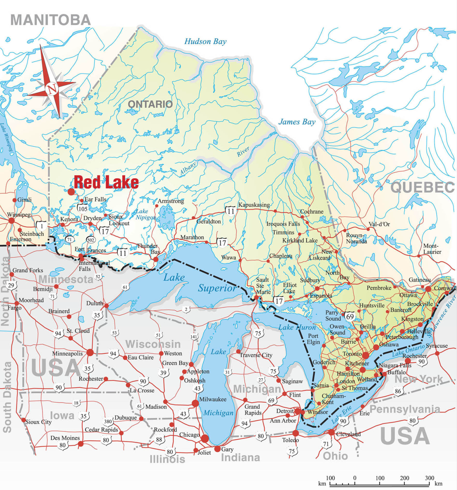
Road Map of Ontario. Select map for a larger view. You may also download a PDF version of the map.
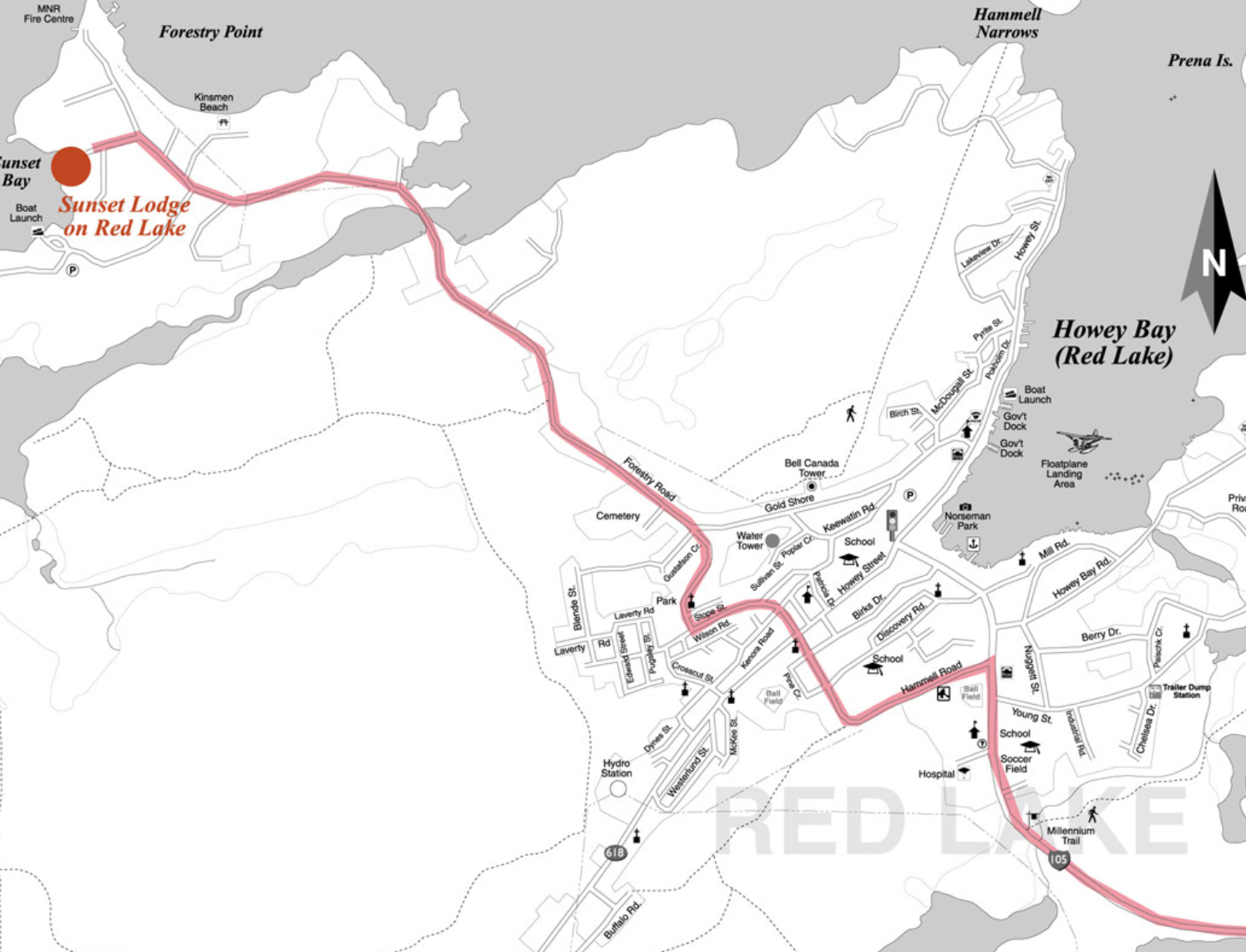
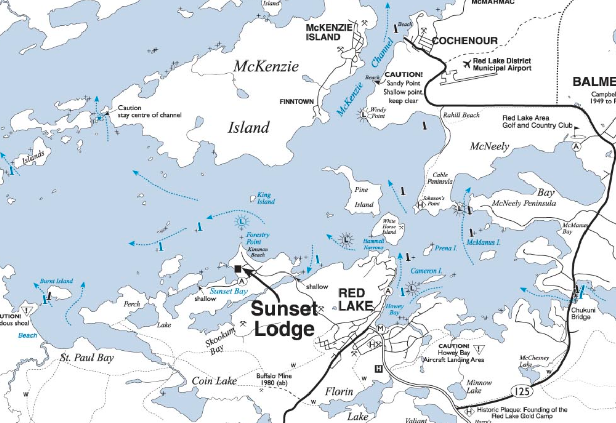
Town of Red Lake, Ontario Map – Select map enlarge the quickest route to Sunset Lodge on Red Lake.
You may also download a PDF version of the map.